


The 10 National Parks in Unganda
1 MURCHISON FALLS NATIONAL PARK
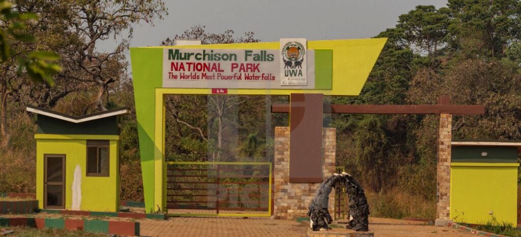
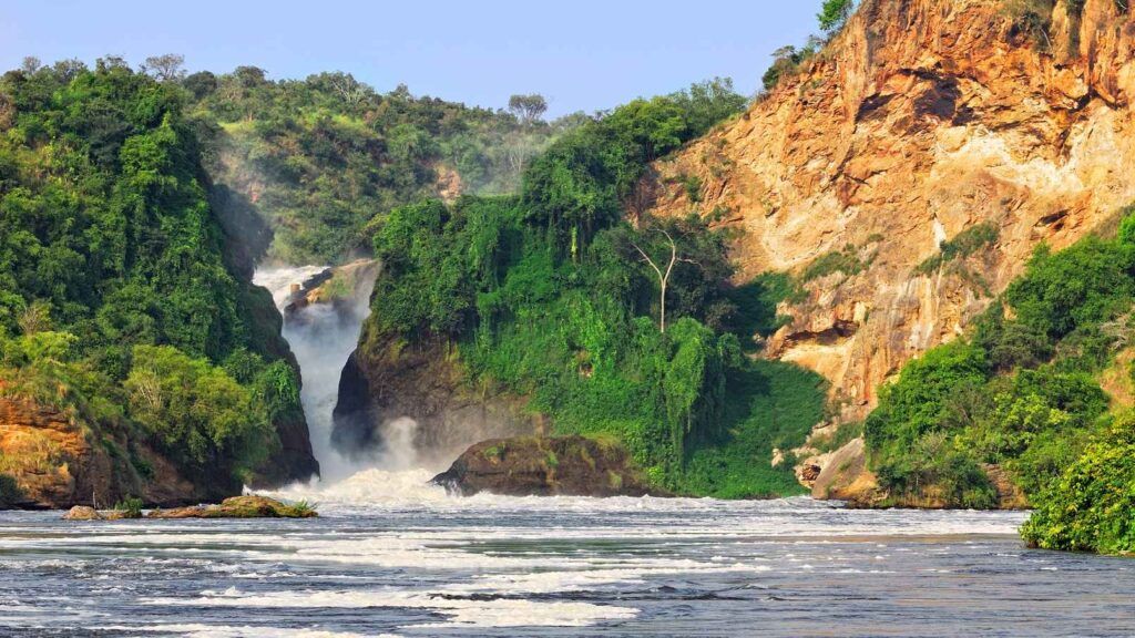
Murchison falls national park is a national park in Uganda managed by the Uganda wildlife authority and it is in north-western Uganda, spreading inland from the shores of lake albert, around the Victoria Nile, up to the Karuma falls and the park also straddles the Ugandan districts of Buliisa, Nwoya, Kiryandongo and Masindi. The park is Uganda’s largest national park which measures approximately 3,893 square kilometers (1,503 sq mi). The park is the location of Murchison falls, where the waters of the Nile flow through a narrow gorge only 7 meters (23 ft) wide before plunging 43 meters (141 ft). Murchison falls national park was first gazette as a game reserve in 1926, and elevated to national park status in 1952.
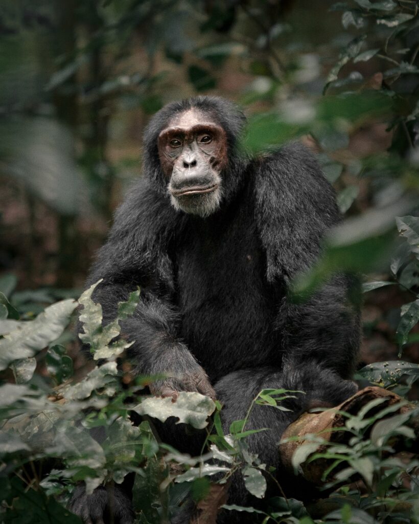
Murchison falls national park is a home to more than 73 animals’ species among which are four the ‘Big five’ including buffaloes, leopards, lions and elephants (except rhinos), has three quarters of the world’s population of Rothschild giraffes plus a healthy population of herbivores which has recently doubled including the Uganda Kobs all of which can easily be seen on the wildlife safari tours here. There are various primates living within its verdant forests like the Budongo among are the over 610 chimpanzees, in addition to 451 bird species including 23 Albertine rift endemics. The park is also the Uganda’s popular and most visited by tourists where they do engage in activities such as night game drive, day game drive, bird watching, nature walks, boat rides to the bottom of the falls and hiking to the top of the falls.
2 QUEEN ELIZABETH NATIONAL PARK
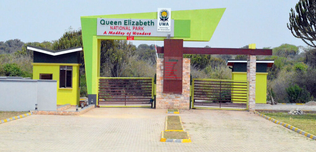
Queen Elizabeth national park (QENP) is in the western region of Uganda, spanning the districts of Kasese, Kamwenge, Rubirizi, and Rukungiri. The park is approximately 400 kilometers (250 mi) by road south-west of Kampala, Uganda’s capital and largest city. The city of Kasese lies to the northeast of the park, while the town of Rubirizi is to the southeast. The park adjoins Kyambura game reserve to the east, which itself adjoins the Kigezi game reserve (including the maramagambo forest) and thus Virunga national park in the Democratic Republic of Congo lies across the border to the west. The park was founded in 1952 as kazinga national park by combining the lake Gorge and lake Edward game reserves, it was renamed two years later to commemorate a visit by Queen Elizabeth 11 and branded as Queen Elizabeth national park.
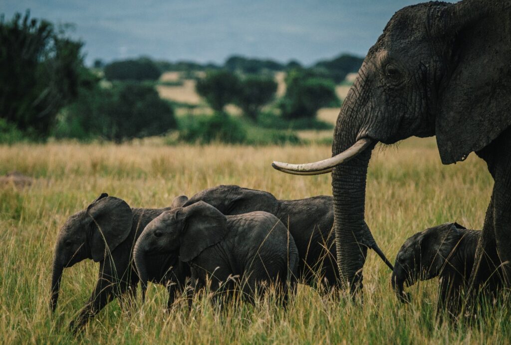
The park occupies an estimated 1,978 square kilometers (764 sq mi). the park is known for its abundant wildlife including African elephant, African buffalo, Ugandan Kob, hippopotamus, Topi, waterbuck, warthog, giant forest hog, Nile crocodile, leopard, spotted hyena, chimpanzee and lion. Overall, the park is a home to 95 mammal species and over 600 bird species. The area around Ishasha in Rukungiri district is famous for its tree climbing lions, whose male often sport black manes.
Queen Elizabeth national park is one of Uganda’s most popular tourist destinations, annually receiving one of the highest number of visitors of any of the country’s national parks. Popular activities include chimp tracking Kyambura gorge, boat cruise, guided game drives including to view tree climbing lions in the Ishasha sector, night game drives and nature walks. Tourists visiting the park make a 7hours 30minutes drive from Kampala to reach the park and the park is also connected by daily domestic flights from Entebbe international Airport which land at Mweya Airstrip, Kihihi Airstrip and Kasese Airstrip.
3 KIDEPO VALLEY NATIONAL PARK

Kidepo valley national park is under Uganda wildlife authority and is a 1,442 square kilometers (557 sq mi) national park in the Karamoja region in northeast Uganda. Kidepo is rugged savannah, dominated by the 2,750 meters (9,020 ft) Mount Morungole and transected by the Kidepo and Narus rivers. The park is further located near Karenga in Kabong district, in the northeastern corner of Uganda. The park is approximately 220 kilometers (140 mi), by road northwest of Moroto, the largest town in the sub region. It is approximately 520 kilometers (320 mi) by road northeast of Kampala, Uganda’s capital and largest city and the northwestern boundary of the park runs along the international frontier with Bira, South Sudan and abuts against its Kidepo game reserve.
It was gazette as a game reserve by the British colonial government in 1958, and the people were evicted. The purpose was both to protect the animals from hunting and to prevent further clearing of bush for tsetse fly control. The eviction of the resident people and the resultant famine, especially the katebo people who were forcefully relocated to other areas within Bira such as Napotpot, Kalo, Namosingo, Loriwo and Naukoli in South Sudan, was cited by the park management. The newly independent government of Uganda under Milton Obote converted the reserve into the Kidepo valley national park in 1962 and the first chief warden of the was Ian Ross, a Briton. In 1972 Paul Ssali a Ugandan replaced him.
Kidepo has a healthy population of the BIG FIVE except for lack of rhinos. Many of these species here are not found elsewhere in Uganda and these include cheetahs, hyenas, caracals, jackals, klipspringers, Aardwolves, bat eared foxes, Dik Diks, ostriches and greater and lesser kudus. Most numerous are elephants, buffalo, zebras, Uganda Kobs and hartebeests. There are plenty of birds exclusive to this park, with nearly 500 species on the checklist.
The park receives comparatively fewer tourists than Uganda’s other national parks, game viewing is possibly by vehicle on dirt roads that crisscross the southern and western parts of the park, other activities include nature walks, lonyii summit hike, guide night drives and bird watching. A few roads are improved with murram and are passable in all weather, the park’s remote location means the drive time for tourists from Kampala is estimated 10 hours well as the park is also connected to domestic flights from Entebbe international Airport which land at Kidepo Airport.
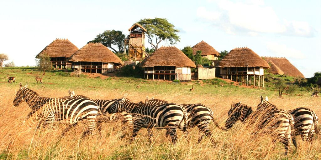
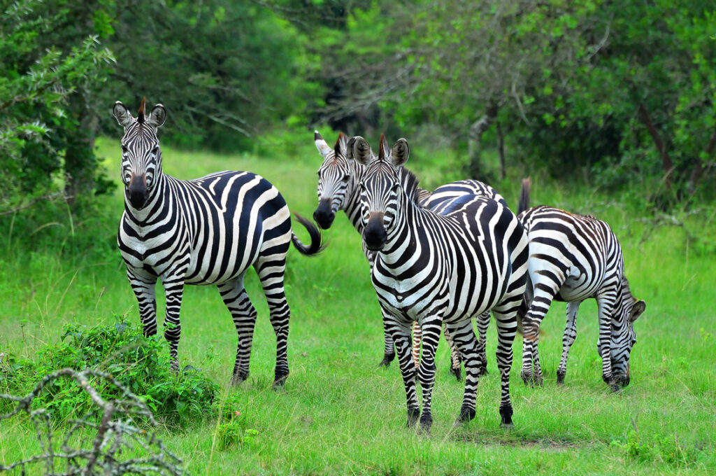
4 LAKE MBURO NATIONAL PARK
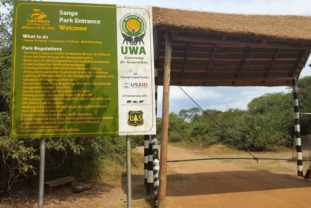
Lake Mburo national park is under Uganda wildlife authority and it’s located in the kiruhura district in the western region of Uganda, about 30 km (19 mi) east of Mbarara and about 240 km (150 mi) by road west of Kampala. The park was originally gazette in 1933 as a controlled hunting area and upgraded to a game reserve in 1963. The region was settled by the Banyankole Bahima pastoralists who traditionally herd Ankole cattle, and still do. The residents continued to graze their cattle in the reserve, a situation described by western conservationists, who termed them invaders in 1981 but were expelled from their lands after it was upgraded to national park status in 1983 as hoped for by some in west. The Obote government’s upgrade decision was intended in part to weaken the Banyankole who supported anti Obote rebels.
In 1985 the second Obote regime fell and the previous residents of lake Mburo re occupied the park’s land, expelling park staff, destroying infrastructure, and killing wildlife. Less than half of the park’s original land area was eventually re-gazetted by the National Resistance Movement government in 1986.
The park hosts zebra, hippopotamus, impala, warthog, common eland, African buffalo and over 300 bird species. Predators may include the lion, leopards, hyenas, genets, African civet, jackals and several and since 2015 there is a population of Rothchild’s giraffe.
5 MT ELGON NATIONAL PARK
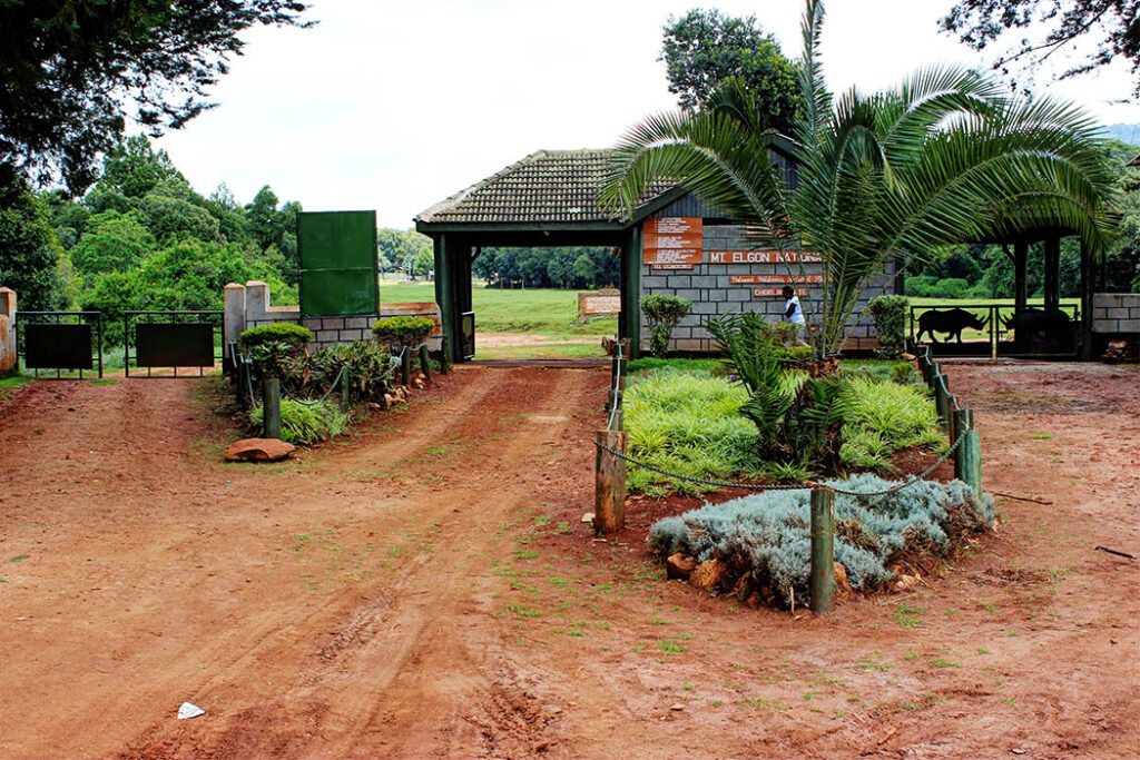
Mt. Elgon national park like other park is under Uganda wildlife authority and the park is 140 km (87 mi) northeast of Lake Victoria. The park covers an area of 1,279 square km (494 sq mi) and bisected by the border of Kenya and Uganda. The Ugandan part of the park covers 1,110 km2 (430 sq mi) while the Kenyan part covers 169 km2 (65 sq mi). the Kenyan part of the park was gazetted in 1968 the Ugandan part in 1992. The park was named after Mount Elgon, an extinct shield volcano on the border of Uganda and Kenya. The park is uniquely split down the middle by Kenya- Uganda border. Mount Elgon is important water catchment for the Nzoia river, which flows to Lake Victoria, and for the Turkwel river (known as the Suam river in Uganda), which flows into lake Turkana.

Elephants and buffalo can be found on the lower slope, the park is also home to variety of small antelope and duiker as well forest monkeys, including the black and white colobus and blue monkey, red tailed monkey have been reported after being thought to be locally extinct, both leopard and hyena exist there. The park is also a home to at least 144 bird species, the park has a variety of scenery; this includes cliffs, caves, waterfalls, gorges, mesas, calderas, hot springs, and the mountain peaks and the other attractions include ancient cave paintings near the trailhead at Budadiri, and hot springs in the former volcano’s crater which bubble at temperatures of up to 48 c.
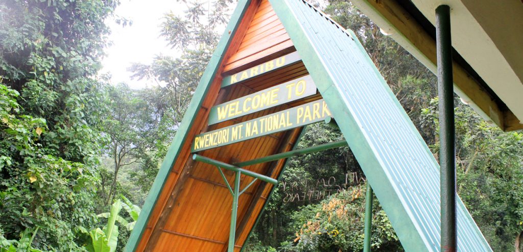
6 RWENZORI MOUNTAINS NATIONAL PARK
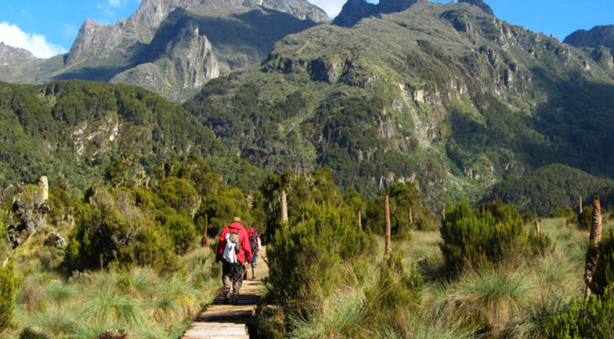
The park is under the protection of Uganda wildlife authority and is a Ugandan national park and UNESCO World Heritage Site located in the Rwenzori mountains. Almost 1,000 km2 (386 sq mi) in size, the park has Africa’s third highest mountain peak and many waterfalls, lakes and glaciers. The park is known for its beautiful plant life. The was established in 1991, it was designated a UNESCO World Heritage site in 1994 because of its outstanding natural beauty. Rebel militias occupied the Rwenzori mountains from 1997 to 2001, the park was inscribed on UNESCO’s list of World Heritage in danger between 1999 and 2004 because of insecurity and lack of resources.
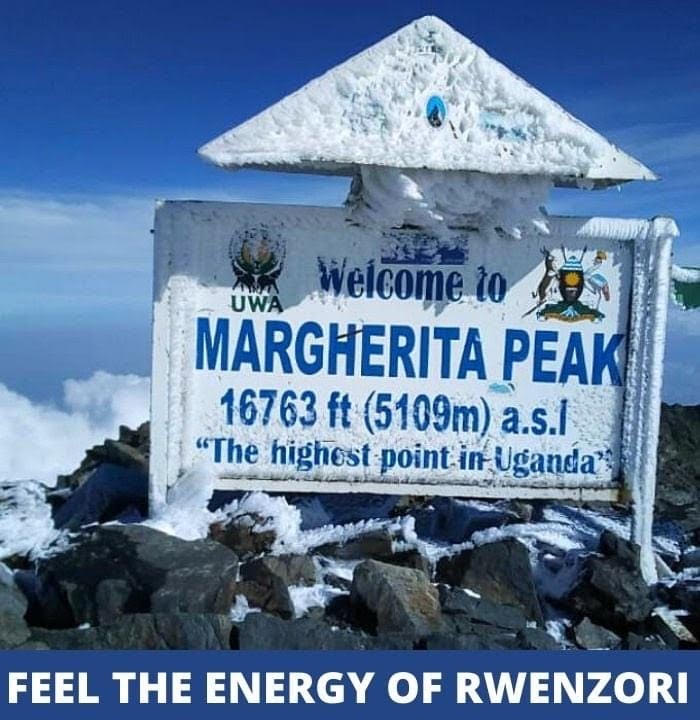
Rwenzori mountains national park is located in south western Uganda on the east side of the western (Albertine) African rift valley. It lies along Uganda border with the Democratic Republic of Congo and borders the DRC’s Virunga national park also a UNESCO site for 50 km (31 mi). it is situated in the Bundibugyo, Kabarole, And Kasese districts, 25 km (16 mi) from the small city of Kasese. It is 996 square km (385 mi) in size, 70% of which exceeds an altitude of 2,500 m (8,200 ft). the park is 120 km (75 mi) long and 48 km (30 mi) wide. Mount Stanley is located in the park, margherita peak one of mount Stanley’s twin summits, is Africa’s third highest peak with a height of 5,109 m (16,762 ft). Africa’s fourth and fifth highest peaks (mount Speke and mount Baker) are also located in the park. The park has glaciers, snowfields, waterfalls, and lakes and is one of Africa’s most beautiful mountain areas. The park has trekking and climbing routes, several with unusual scenery. The most popular trek is a seven-day circuit of the peak.
There are five distinct vegetation zones in the park which changes according to changes in the altitude. The park has 89 species of birds, 15 species of butterfly, and four primate species. The park’s wildlife varies with elevation, and its species include the forest elephant, chimpanzee, hyrax, black and white colobus, Lhotse’s monkeys, Ruwenzori duiker and Rwenzori turaco.
7 KIBALE NATIONAL PARK
The park is also the protection of Uganda wildlife authority and it is found in western Uganda, protecting moist evergreen rainforest. It is 766 sq km (296 sq mi) in size and ranges between 1,100 sq km (3,600 ft) and 1,600 m (5,200 ft) in elevation. Despite encompassing primarily moist evergreen forest, it contains a diverse array of landscapes. Kibale is one of the last remaining expanses to contain both lowland and montane forests. In eastern Africa it sustains the last significant expanse of pre montane forest.
The park was gazette in 1932 and formally established in 1993 to protect a large area of forest previously managed as a logged forest with Queen Elizabeth national park. This adjoining of the parks creates a 180 km (110 mi) wildlife corridor. It is an important ecotourism and safari destination, well known for its population of habituated chimpanzees and twelve other species of primates. It is also the location of the Makerere university biological field station.
The park is a popular destination for tourist to track the chimpanzees in Uganda. Chimpanzee tracking has taken place in the park since 1993 with successful tracking rates of 90%, the other popular tourism activities include the chimpanzee habituation exercise, nature walks and bird watching. Tourists visiting the park make 5 hours’ drive from Kampala to reach the park, the park is also connected to domestic flights from kajjansi airfield and Murchison falls national park which land at Fort portal airstrip.
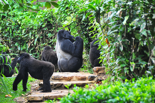
8 BWINDI IMPENETRABLE NATIONAL PARK
The park is under Uganda wildlife authority and it’s located in southwestern Uganda, the park is part of the Bwindi impenetrable forest and is situated along the Democratic Republic of Congo border next to the Albertine rift, composed of 321 sq km (124 sq mi) of both montane and lowland forest, it is accessible only on foot. BINP is a united nations education, scientific and cultural organization designated world heritage site.
It provides habitat for 120 species of mammals, 350 species of birds, 310 species of butterflies, 27 species of frogs, chameleons, geckos, and many endangered species. Floristically, the park is among the most diverse forests in East Africa, including 200 species of trees and 104 species of ferns. The park is a sanctuary for colobus monkeys, chimpanzees, and many birds such as hornbills and turacos. It is most notable for the 400 Bwindi gorillas, half of the world’s population of the endangered gorilla groups are open to tourism in four different sectors of Buhoma, Ruhijja, Rushaga and the Nkuringo in the districts of Kanungu, Kabale and Kisoro respectively all under the management UWA.
Tourists may visit the park any time during the year, although conditions in the park are more difficult during the rainy season. The park is in a remote location and the roads are in poor condition, the drive from Kampala is estimated 8 hours. The park is connected to domestic flights from Entebbe international airport which land at Kihihi airstrip and Kisoro airstrip.
9 MGAHINGA NATIONAL PARK
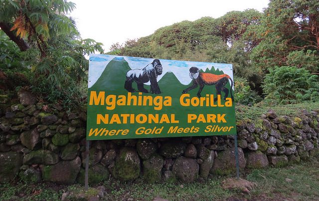
The is under Uganda wildlife authority and it’s found in southwestern Uganda, it was created in 1991 and it covers 33.9 km2 (13.1 sq mi). The park is about 15 km (9.3 mi) by road south of the town of Kisoro and approximately 55 km (34 mi) by road west of Kabale the largest city in the sub region. The area experiences two wet rainy seasons; February to May and September to December. The average monthly rainfall varies from 250 mm (9.8 in) in October to 10 mm (0.39 in) in July. The national park encompasses bamboo forest, Albertine rift montane forests, Ruwenzori Virunga montane moorlands with tree heath and an alpine zone at higher altitudes. Primates present in the park include mountain gorillas and golden monkey. The iconic mountain gorillas and the charismatic golden monkey, the checklist of 76 mammal’s species include black and white colobus, leopards, elephants, giant forest hog, bushpig, buffalo, bushbuck, black fronted duiker, and several varieties of rodents, bats and small predators.
The park is the smallest national park in Uganda receiving one of the fewest annual visitor numbers of any national park in Uganda. Popular tourist activities include mountain gorilla tracking, golden monkey tracing, volcano hiking, nature walks including to the gorge platform, birdwatching and meeting the Batwa community. You take 9 hours’ drive from kampala to reach the park, the park is also connected to domestic flights from Entebbe international airport and to Kihihi airstrip which land at Kisoro airstrip.
10 SEMULIKI NATIONAL PARK
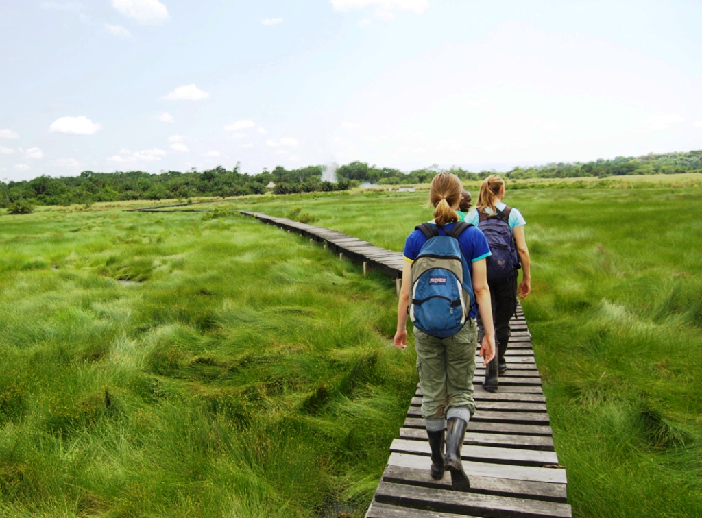
The park is under the protection Uganda wildlife authority and it’s located in Bwamba county, a remote part of the Bundibugyo district in the western region of Uganda that was established in October 1993. It encompasses 219 km2 (85 sq mi) of Eastern Africa’s only lowland tropical rainforest. It is one of the richest areas of floral and faunal biodiversity in Africa, with bird and butterfly species being especially diverse.
The lies on the Uganda’s border with the Democratic Republic of Congo, the Rwenzori mountains are to the south east of the park while lake Albert is to the park’s north. The park lies within the Albertine rift, the western arm of the East African rift. The park is further known and famous of its hot springs (SEMPAYA HOT SPRING) making it the best site for hot spring experience.
From 1932 to 1993, the area covered by Semiliki national park was managed as a forest reserve, initially by the colonial government and then by the Ugandan government’s forest department. It was made a national park by the government in October 1993 to protect the forests as an integral part of the protected areas of the western rift valley.
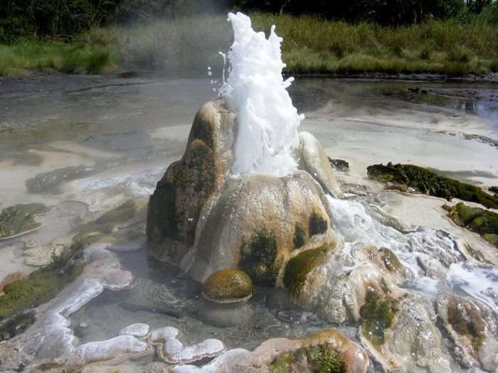
The park visitors can engage in birdwatching, walking to the savannah grassland, hiking through the 13 km (8.1 mi) kirumia trail, and visit the hot springs where the water is hot enough to cook eggs and plantains.
SHORTLIST OF THE 10 NATIONAL PARKS IN UGANDA
1 Murchison falls national park.
2 Queen Elizabeth national park.
3 Kidepo Valley national park.
4 Lake Mburo national park.
5 Mt Elgon national park.
6 Rwenzori mountains national park.
7 Kibale national park.
8 Bwindi Impenetrable national park.
9 Mgahinga national park.
10 Semiliki national park.

